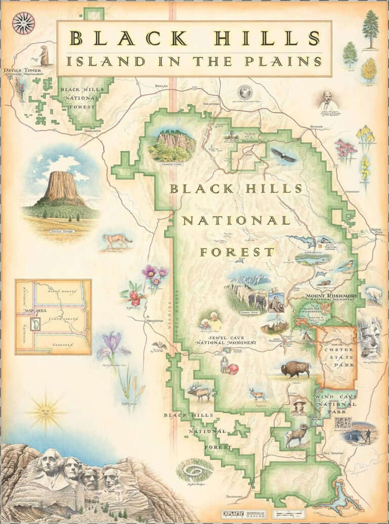
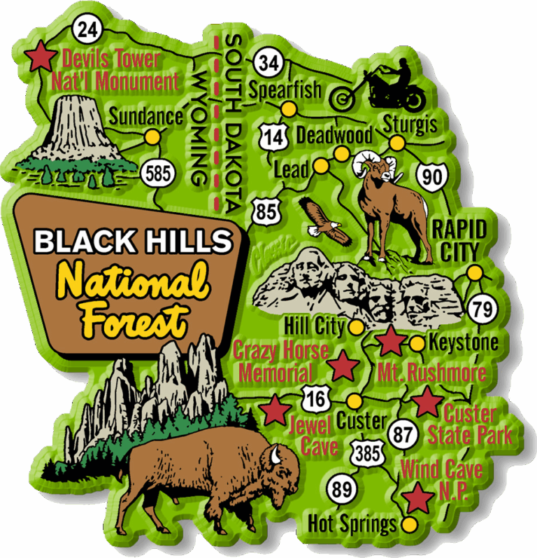
The Black Hills National Forest spans an impressive 1.25 million acres across western South Dakota and eastern Wyoming, offering visitors a treasure trove of natural wonders beyond the famous Mount Rushmore. Whether you’re researching black hills national forest camping options, searching for a reliable black hills national forest map, wondering where is black hills national forest exactly located, or exploring what to do in black hills national forest, this comprehensive guide will help you plan an unforgettable adventure in one of America’s most diverse and historically significant national forests.
History and Significance of the Black Hills
Established in 1897, the Black Hills National Forest has a rich and complex history. Long before becoming a designated forest, this land held profound cultural significance for numerous Native American tribes, including the Lakota, Arapaho, Cheyenne, and Kiowa peoples, who consider these hills sacred ground.
The landscape’s history took a dramatic turn in the 1870s when gold was discovered in the region, triggering a gold rush that forever changed the area. This discovery led to the controversial acquisition of the land from Native American tribes, despite previous treaties guaranteeing their ownership. The 1868 Fort Laramie Treaty had recognized the Black Hills as part of the Great Sioux Reservation, but the discovery of gold prompted the U.S. government to pressure the tribes to sell the land. Today, a Black Hills National Forest map offers a glimpse into the vast and storied landscape shaped by centuries of cultural, historical, and environmental transformation.
Geography and Natural Features
Landscape and Ecosystems
The Black Hills National Forest earned its name from the Lakota phrase “Paha Sapa,” meaning “hills that are black.” From a distance, the dense ponderosa pine forests covering the hills create a dark appearance against the surrounding plains, giving the region its distinctive name.
This unique landscape represents an “island” of forested hills rising dramatically from the surrounding Great Plains. The forest’s elevation ranges from about 3,500 feet to over 7,200 feet at Black Elk Peak, creating diverse microclimates and ecosystems throughout the region.
Wildlife
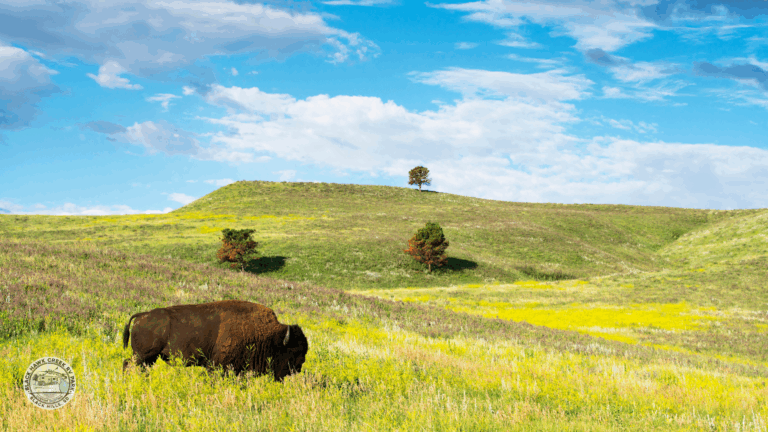
The varied ecosystems of the Black Hills National Forest support an impressive array of wildlife. Large mammals roam these forests, including white-tailed and mule deer, elk, bighorn sheep, and mountain goats. While not common within the national forest boundaries, bison can be spotted in nearby Custer State Park.
Smaller mammals abound, from black bears and mountain lions to bobcats, coyotes, and foxes. Prairie dog towns create important habitat for numerous species, including the endangered black-footed ferret. Birdwatchers will delight in spotting wild turkeys, various woodpeckers, golden eagles, and numerous songbirds.
Remarkable Cave Systems
The Black Hills National Forest region boasts some of the world’s most extraordinary cave systems, formed through millions of years of water slowly dissolving the limestone bedrock. Exploring these hidden wonders is even easier with a Black Hills National Forest map, which helps visitors navigate the surrounding trails and nearby attractions.
Wind Cave National Park, adjacent to the forest’s southern boundary, protects one of the world’s longest and most complex cave systems. With over 150 miles of mapped passages, it’s known for containing 95% of the world’s discovered boxwork formations—delicate, honeycomb-like calcite structures that project from the cave walls and ceilings.
Top Attractions and Natural Wonders
Black Elk Peak
Rising to 7,244 feet, Black Elk Peak (formerly known as Harney Peak) stands as South Dakota’s highest point and offers one of the most rewarding hiking experiences in the Black Hills National Forest. The summit rewards hikers with panoramic views spanning four states on clear days.
Several trails lead to the peak, with the most popular route starting at Sylvan Lake in Custer State Park. This 7-mile round-trip hike gains approximately 1,100 feet of elevation and takes most hikers 3-4 hours to complete. The trail winds through ponderosa pine forests, past granite outcroppings, and offers increasingly spectacular views as you climb.
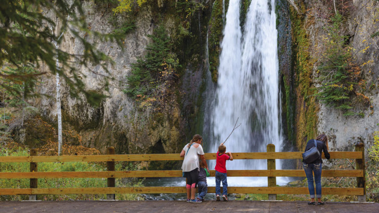
Spearfish Canyon and Waterfalls
Spearfish Canyon represents one of the most spectacular natural features in the Black Hills National Forest. This 1,000-foot-deep limestone gorge carved by Spearfish Creek offers breathtaking scenery accessible via the 19-mile Spearfish Canyon Scenic Byway (US Highway 14A).
The canyon’s towering limestone walls are draped with spruce, pine, aspen, and birch trees, creating a stunning display of colors, especially during autumn. Several magnificent waterfalls grace the canyon:
- Bridal Veil Falls cascades 60 feet down a limestone cliff and is visible from a roadside pullout at mile marker 17.
- Roughlock Falls tumbles in a series of steps through a beautiful forested setting and is accessible via a short, wheelchair-friendly trail.
- Spearfish Falls drops 47 feet and can be reached via a moderate 1.5-mile round-trip hike from the Spearfish Canyon Lodge.
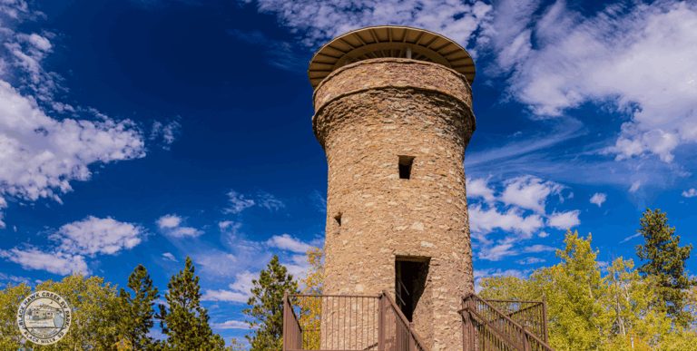
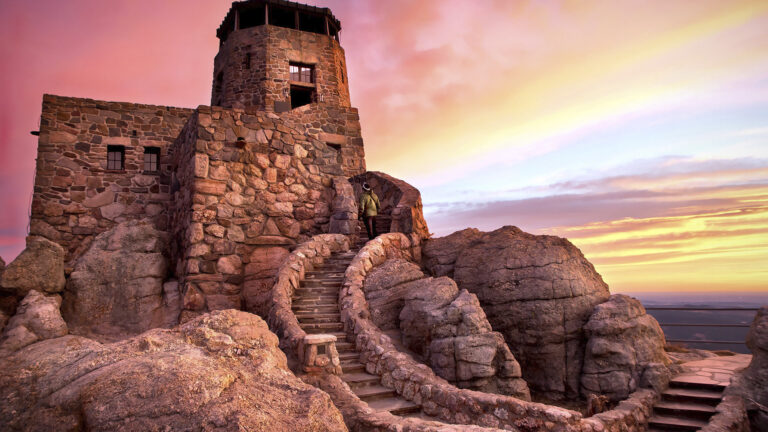
Mt Roosevelt Friendship Tower
The Mount Roosevelt Friendship Tower stands as a unique historical monument within the Black Hills National Forest. Built in 1919 by Seth Bullock, the first sheriff of Deadwood and a close friend of President Theodore Roosevelt, this 31-foot stone tower commemorates their friendship and Roosevelt’s conservation legacy.
Located near Deadwood, the tower offers spectacular views of the surrounding forest and nearby communities. A short, moderately steep 0.6-mile trail leads visitors from the parking area to the tower. Interpretive signs along the way explain the tower’s history and significance.
The site includes picnic tables and makes for a perfect half-day excursion when exploring the northern Black Hills. There are no fees to visit this historic landmark, and it’s accessible from late spring through fall, though winter access may be limited by snow conditions.
Mining History and Heritage
The Black Hills National Forest region’s development is inextricably linked to its mining history, particularly following the 1874 discovery of gold during General George Custer’s Black Hills Expedition. This discovery triggered one of America’s last great gold rushes, dramatically transforming the landscape and establishing communities that still thrive today. Exploring a Black Hills National Forest map offers valuable insight into how the geography shaped these historical events and the mining routes that once bustled with activity.
The Homestake Mine in Lead stands as the most significant mining operation in the region’s history. Operating from 1876 until 2002, it was once North America’s largest and deepest gold mine, producing more than 40 million ounces of gold during its 126-year history. Today, the former mine serves science as the site of the Sanford Underground Research Facility, where physicists conduct groundbreaking neutrino and dark matter research.
Recreational Activities
Hiking and Backpacking
With over 450 miles of trails, the Black Hills National Forest offers hiking opportunities for every skill level, from casual walkers to serious backpackers. The forest’s diverse terrain provides everything from easy nature walks to challenging multi-day treks.
Beyond the popular Black Elk Peak trail, hikers should consider these noteworthy options:
- The 109-mile George S. Mickelson Trail follows a converted railroad bed through the heart of the Black Hills, offering a relatively flat, accessible route with 15 trailheads. The trail passes through scenic valleys, old mining towns, and forests, making it perfect for day hikes or longer journeys.
- The Centennial Trail stretches 111 miles from Bear Butte State Park to Wind Cave National Park, traversing the entire length of the Black Hills National Forest and offering a premier backpacking experience.
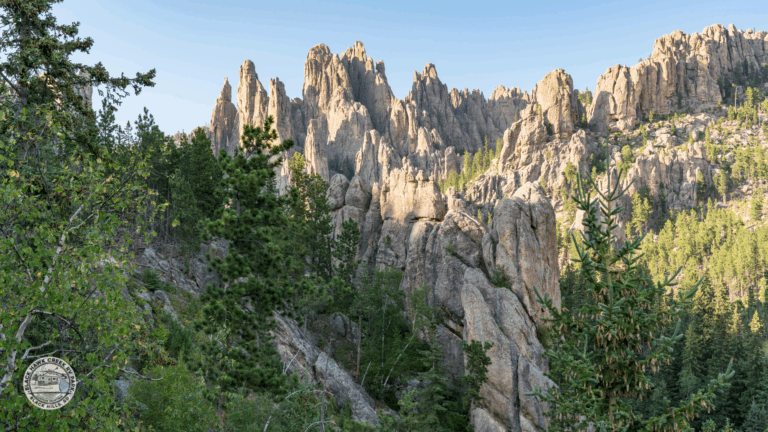
- The Sunday Gulch Trail near Sylvan Lake provides a challenging 3-mile loop featuring unique rock formations and stream crossings.
- The Flume Trail follows an 1880s water flume that once carried water to mining operations, offering historical interest alongside natural beauty.
Backcountry camping is permitted throughout most of the forest, though some areas require permits. Hikers should always practice Leave No Trace principles, carry plenty of water, and be prepared for rapidly changing weather conditions. A detailed Black Hills National Forest map is essential for navigation, especially in remote areas.
Fishing and Water Activities
The Black Hills National Forest contains approximately 1,300 miles of streams and numerous lakes that provide excellent fishing opportunities. Cold, clear waters support healthy populations of brook, brown, and rainbow trout, making this a premier destination for anglers.
Popular fishing spots include:
- Spearfish Creek, renowned for its blue-ribbon trout fishing
- Pactola Reservoir, the largest body of water in the Black Hills, offering trout, pike, and perch
- Sheridan Lake, a family-friendly destination with good shore fishing access
- Deerfield Lake, known for its peaceful setting and quality trout fishing
South Dakota fishing licenses are required and can be purchased online or from local sporting goods stores. Special regulations may apply to certain waters, so check current rules before fishing.
Horseback Riding
Exploring the Black Hills National Forest on horseback connects visitors to the region’s frontier heritage while accessing beautiful areas sometimes difficult to reach on foot. The forest maintains numerous horse-friendly trails with varying difficulty levels.
Popular equestrian routes include:
- The Centennial Trail, which allows horseback riding along most of its 111-mile length
- The Iron Creek Horse Camp area, offering several loop trails specifically designed for riders
- The Crow Peak trails near Spearfish, providing challenging terrain and spectacular views
Several authorized vendors offer guided horseback riding experiences for visitors without their own horses. Elk Haven Horse Camp near Hill City provides guided rides ranging from one-hour excursions to full-day adventures. These guided trips are ideal for beginners or those wanting to learn about the forest’s history and ecology from knowledgeable local guides. It’s a perfect complement to your Black Hills National Forest camping experience, offering both relaxation and adventure in the heart of nature.
Riders bringing their own horses will find several equestrian campgrounds throughout the forest, including Iron Creek Horse Camp and Willow Creek Horse Camp, which offer corrals, hitching posts, and easy trail access. When choosing the best RV for winter, horse owners should consider models with appropriate towing capacity for horse trailers.
Stargazing
The Black Hills National Forest offers exceptional stargazing opportunities thanks to its relatively remote location and minimal light pollution. On clear nights, visitors can witness the Milky Way stretching across the sky, observe numerous constellations, and potentially spot planets, meteor showers, and even the Northern Lights during strong geomagnetic storms.
Prime stargazing locations include:
- Deerfield Lake, where the dark skies and reflective water create stunning views
- Black Elk Peak, offering elevated viewing above much of the forest canopy
- The Norbeck Overlook on Highway 87 provides a convenient roadside spot with open sky views
For the best experience, plan your stargazing during a new moon when the sky is darkest. Summer and early fall offer comfortable nighttime temperatures, though winter provides the darkest skies for serious astronomers. Bring red-filtered flashlights to preserve night vision, dress warmly even in summer, and consider bringing a star chart or astronomy app to identify celestial objects.
Seasonal Considerations and Best Times to Visit
Spring (April-May)
Spring in the Black Hills National Forest brings renewal as the landscape awakens from winter. Temperatures gradually warm, though visitors should prepare for variable conditions, including occasional late snowstorms, especially at higher elevations.
This shoulder season offers several advantages:
- Wildflowers begin blooming, particularly in meadows and along streams
- Wildlife becomes more active, with increased opportunities for viewing
- Waterfalls run at peak flow from snowmelt
- Significantly fewer crowds than summer months
- Lower rates for accommodations
However, spring visitors should note that some forest roads may remain closed due to mud or lingering snow, and some facilities operate on limited schedules until the summer season begins. Pack layers and be prepared for rapidly changing weather conditions.
Summer (June-August)
Summer represents the peak tourist season in the Black Hills National Forest, with warm days, cool nights, and the full range of activities and services available. Daytime temperatures typically range from 70-85°F, though higher elevations remain cooler.
Summer highlights include:
- All forest roads, campgrounds, and visitor facilities are operating at full capacity
- Perfect conditions for hiking, fishing, and water activities
- Lush, green forests and abundant wildlife
- Numerous regional events and festivals
- Extended daylight hours for maximizing outdoor adventures
The primary drawback to summer visits is the larger crowds, particularly in July and early August. Afternoon thunderstorms are common, so plan morning activities and have indoor alternatives for afternoons. Advance reservations for Black Hills National Forest camping are essential during this busy period, especially on weekends and holidays.
Fall (September-October)
Many consider fall the ideal time to visit the Black Hills National Forest. As summer crowds diminish, the forest transforms with spectacular autumn colors, particularly from late September through mid-October when aspen groves turn brilliant gold against the evergreen backdrop.
Fall advantages include:
- Comfortable temperatures with warm days and crisp nights
- Spectacular fall foliage, especially in Spearfish Canyon
- Reduced crowds after Labor Day
- Wildlife is becoming more active, preparing for winter
- Easier availability of camping sites and accommodations
Most facilities remain open through September, though services begin reducing hours in October. Fall visitors should pack layers for temperature fluctuations and be aware that the first snowfall can occur as early as October at higher elevations.
Winter (November-March)
Winter transforms the Black Hills National Forest into a serene snow-covered landscape, offering unique recreational opportunities. While temperatures can be quite cold, averaging 20-40°F during the day and often dropping below zero at night, the forest’s relatively mild winters compared to the surrounding plains make it accessible year-round.
Winter activities include:
- Snowshoeing and cross-country skiing on summer hiking trails
- Snowmobiling on over 350 miles of groomed trails
- Ice fishing on frozen lakes
- Wildlife viewing against snowy backgrounds
- Photography of frost-covered landscapes
Many forest roads close during winter, but main highways remain plowed and accessible. Services are limited, with most campgrounds closed and visitor centers operating on reduced schedules. Winter visitors should be well-prepared with appropriate clothing, emergency supplies, and proper RV insulation if staying in recreational vehicles.
Practical Information for Visitors
Access and Transportation
The Black Hills National Forest is highly accessible by road, with several major highways traversing or bordering the forest. Interstate 90 runs along the northern edge, while US Highways 16, 385, and 85 provide access from various directions. Black Hills National Forest camping spots are conveniently located near these routes, making it easy for visitors to reach their chosen sites.
The nearest major airport is Rapid City Regional Airport (RAP), located about 10 miles southeast of Rapid City. This airport offers daily flights from several major hubs, including Denver, Minneapolis, Chicago, and Dallas. Rental cars are available at the airport and strongly recommended for exploring the region and accessing remote Black Hills National Forest camping areas.
Most main forest roads are paved or well-maintained gravel, suitable for standard passenger vehicles. However, some remote areas and forest service roads may require high-clearance or 4WD vehicles, especially after rain or during spring thaw. Always check current road conditions before venturing onto unpaved forest roads.
Permits and Fees
Unlike national parks, entry to the Black Hills National Forest is free, with no entrance stations or day-use fees for general forest access. However, certain activities and facilities do require permits or fees:
- Developed campgrounds charge nightly fees ranging from $18-26, depending on amenities.
- South Dakota fishing licenses are required for anyone 16 or older fishing in forest waters.
- Hunting requires appropriate South Dakota or Wyoming licenses, depending on location.
- Firewood gathering permits are available for personal use collection.
- Commercial activities, including guided services, require special use permits.
The America the Beautiful Pass (National Parks and Federal Recreational Lands Pass) provides discounts on some amenity fees within the forest, such as campground rates, but is not required for general forest access.
Safety Considerations
The Black Hills National Forest offers a generally safe environment for recreation, but visitors should take appropriate precautions:
- Wildlife: While dangerous encounters are rare, the forest is home to mountain lions, black bears, and rattlesnakes. Maintain awareness, make noise while hiking, properly store food at campsites, and know appropriate responses for wildlife encounters.
- Weather: Conditions can change rapidly. Check forecasts before outings and be prepared for afternoon thunderstorms in summer and sudden snowstorms in shoulder seasons. Lightning is a significant hazard during summer storms.
- Navigation: Cell service is unreliable throughout much of the forest. Carry physical maps, a compass, and download offline maps before venturing into remote areas. A detailed black hills national forest map is essential for backcountry travel.
- Water: Not all water sources are safe to drink without treatment. Carry adequate water or reliable purification methods.
- Fire: Check current fire restrictions before building campfires. During dry periods, restrictions may prohibit open flames entirely.
Conservation and Responsible Tourism
The Black Hills National Forest faces numerous conservation challenges, including forest health, wildfire management, and balancing recreational use with ecosystem protection. Visitors can help preserve this special place by practicing responsible tourism.
The Leave No Trace principles provide essential guidelines:
- Plan ahead and prepare to minimize unexpected impacts
- Travel and camp on durable surfaces
- Dispose of waste properly
- Leave what you find, including natural objects and cultural artifacts
- Minimize campfire impacts
- Respect wildlife by observing from a distance
- Be considerate of other visitors