Table of contents
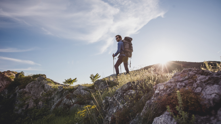
If you’re an avid hiker visiting Custer State Park, one trail you can’t miss is Black Elk Peak. Formerly known as Harney Peak, Black Elk Peak in South Dakota is the highest natural point in the state and offers breathtaking views of the surrounding Black Hills. The Black Elk Peak hike is a favorite among outdoor enthusiasts, but it can be a bit confusing due to multiple trailheads and routes leading to the summit. This complete guide will help you tackle this challenging yet rewarding hike like a pro.
Why is The Black Elk Peak Hike Confusing?
The Black Elk Peak (Harney Peak) hiking trail is known for its confusing network of routes and trailheads, which can perplex even seasoned hikers. Several different trails lead to the summit of Black Elk Peak, each with its own unique features and difficulty levels. Choosing the best route for your Black Elk Peak hike can be challenging, as you need to consider factors such as distance, elevation gain, and trail conditions. Additionally, it’s essential to plan your descent route to avoid getting lost or taking a more strenuous path back down.
Navigating the trail network requires careful planning and attention to detail, especially since the trails are interconnected and share junctions with other popular paths in the area. Being prepared and knowing which trailheads and routes you’ll use will make your Black Elk Peak hike a more enjoyable and less confusing experience.
Things You Should Know Before You Go
Before embarking on your Black Elk Peak (Harney Peak) hike, there are several important things to keep in mind:
- Entrance Fee: Custer State Park charges a $20 entrance fee per vehicle, valid for a week. An annual pass is available for $36. You can purchase passes at all five park entrances.
- Park Hours: The park is open 24 hours a day, seven days a week. You can start your hike at any time, but make sure you’re prepared for changing weather and have the necessary gear for hiking in the dark if you start early or late in the day.
- Wildlife: Be cautious of wildlife on the trail. Maintain a safe distance and do not feed any animals.
- Parking: The parking areas fill up quickly during the summer and on weekends. Arrive early to secure a spot close to your chosen trailhead.
- Weather: Thunderstorms can develop quickly. Check the weather forecast and avoid hiking during inclement weather, especially near swimming holes.
- Pets: Pets are allowed but must be kept on a leash no longer than 10 feet. They are not allowed in park buildings or on beaches.
- Leave No Trace: Follow Leave No Trace principles to keep the park pristine for future visitors.
How to Get There
Reaching the Black Elk Peak (Harney Peak) hiking trail entrance is relatively straightforward, but it’s important to know the best route to ensure a smooth start to your adventure. Black Elk Peak is located within Custer State Park in the Black Hills of South Dakota, and there are multiple trailheads you can use to begin your hike.
From Rapid City
- Start on US-16W: Head west on US-16W from Rapid City. This is the main route that will take you towards Custer State Park.
- Merge onto US-16A: After about 20 miles, merge onto US-16A, which leads directly into the heart of the park.
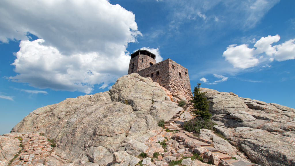
- Follow Signs to Sylvan Lake: Once you enter Custer State Park, follow the signs directing you to Sylvan Lake. Sylvan Lake is a popular starting point for many Black Elk Peak hikes and provides access to Trail #9, the most common route to the summit.
- Arrive at Sylvan Lake: The Sylvan Lake parking area is well-marked and provides ample parking. The trailhead for Black Elk Peak Trail #9 is easily accessible from the parking lot beside the lake.
From Custer
- Head East on US-16A: If you’re starting from the town of Custer, take US-16A east towards Custer State Park.
- Turn onto SD-87: About 3 miles from Custer, turn left onto SD-87 (Needles Highway). This scenic route will take you directly to Sylvan Lake.
- Follow Needles Highway to Sylvan Lake: Drive approximately 7 miles along Needles Highway until you reach the Sylvan Lake area. The parking lot for the trailhead is located next to the lake.
From Hill City
- Take US-385 South: Begin your journey on US-385 heading south from Hill City.
- Turn onto SD-87: After about 6 miles, turn left onto SD-87 (Needles Highway).
- Continue to Sylvan Lake: Follow SD-87 for approximately 6 miles until you reach the Sylvan Lake area, where you’ll find the trailhead parking.
Using GPS
For those using a GPS device, enter “Sylvan Lake, Custer State Park, SD” as your destination. This will guide you directly to the main starting point for the Black Elk Peak Trail #9.
Parking Information
- Arrive Early: The parking lots at Sylvan Lake can fill up quickly, especially during peak hiking seasons (summer and weekends). Arriving early in the morning is recommended to secure a spot close to the trailhead.
- Additional Parking: If the Sylvan Lake lot is full, there are additional parking areas nearby, but they may require a short walk to reach the trailhead.
Popular Black Elk Peak Trails
One of the best aspects of hiking Black Elk Peak is the variety of trails available to reach the summit. Here are some of the most popular routes:
Sylvan Lake #9
- Round-trip distance: 7 miles
- Round-trip time: 2-4 hours
- Elevation: 1,100 feet
- Difficulty: Difficult going up, moderate coming down
- Directions: The trailhead is easy to locate from the parking lot beside Sylvan Lake. It is the most traveled and shortest route to Black Elk Peak. Note that this route requires paid entry into Custer State Park.
Little Devils Tower #4
- Round-trip distance: 7 miles
- Round-trip time: 2-4 hours
- Elevation: 1,100 feet
- Difficulty: Moderate to strenuous, ending with a scramble to the top of Little Devils Tower
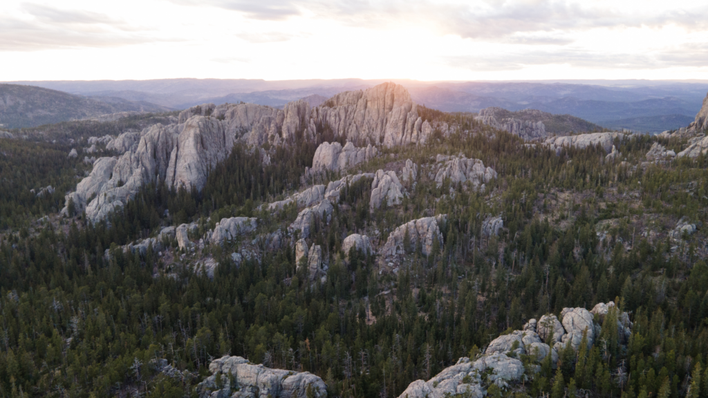
- Directions: After scrambling up Little Devils Tower, hikers can see the famous Cathedral Spires, Black Elk Peak’s fire tower, and the backside of Mount Rushmore. Including Little Devils Tower adds time to your Black Elk Peak hike, but it’s a rewarding route.
Willow Creek #9
- Round-trip distance: 12.6 miles
- Round-trip time: Approximately 8 hours
- Elevation: 2,200 feet
- Difficulty: Moderate to difficult
- Directions: Found along SD-244, approximately 6 miles west of Mount Rushmore. Follow Trail #8 to connect with Black Elk Peak Trail #9. For a loop, hike south on Trail #9 from the summit and take Lost Cabin Trail #2 to Willow Creek Horse Camp.
Norbeck Trail #3
- Round-trip distance: 10 miles using Norbeck Trailhead, 14 miles using Iron Creek Horse Camp
- Elevation: 2,076 feet
- Difficulty: Moderate
- Directions: Accessible from Forest Road 345, approximately 8 miles southeast of Sylvan Lake on Needles Highway. Take Norbeck Trail #3 to Trail #9 and head to the summit. Iron Creek Horse Camp is 8 miles east on Needles Highway.
Grizzly Bear Trail #7
- Round-trip distance: 12.6 miles
- Elevation: 1,500 feet
- Difficulty: Moderate to difficult
- Directions: Accessible from Forest Road 345, approximately 8 miles southeast of Sylvan Lake. Take Grizzly Bear Creek Trail #7 to Trail #3 or Trail #9 and head to the summit.
Cathedral Spires Trailhead #4A
- Round-trip distance: 7 miles
- Difficulty: Difficult with a scramble to the top of Little Devils Tower
- Directions: The trailhead is 2 miles east of Sylvan Lake on Needles Highway. Link up with Trail #4 to find Black Elk Peak Trail #9.
Horsethief Lake
- Round-trip distance: 2.7 miles, but can be extended to 13 miles
- Difficulty: Moderate
- Directions: Located approximately 2 miles west of Mount Rushmore on Highway 244. Start at Horsethief Lake Trail #14, then take Grizzly Bear Creek Trail #7, Norbeck Trail #3, and Black Elk Peak Trail #9.
Lost Cabin Route
- Round-trip distance: 13 miles
- Difficulty: Moderate to difficult
- Directions: Drive 1/3 mile west of the Mount Rushmore KOA at Palmer Gulch on Highway 244, then continue 1 mile on Palmer Creek Road to find Palmer Creek Trailhead. Take Lost Cabin Trail #2 to Black Elk Peak Trail.
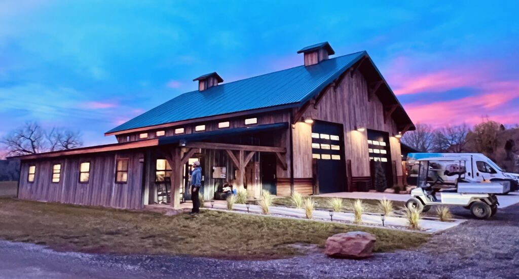
Stay at Black Hawk Creek RV Park
Planning a visit to Black Elk Peak in Custer State Park? Consider staying at Black Hawk Creek RV Park & Cabins. Located just 2 miles from the interstate and a 5-minute drive from Rapid City, Black Hawk Creek RV Park offers convenient access to South Dakota’s most iconic attractions. The park provides various accommodations, from spacious RV sites to cozy cabins, making it an ideal base for your Black Elk Peak hike and other local adventures.
Whether you’re exploring Mount Rushmore, Crazy Horse, Badlands National Park, Devils Tower, or the historic town of Deadwood, Black Hawk Creek RV Park ensures you’re never far from the action. Book your stay today and unlock the door to a world of exploration, relaxation, and comfort in the heart of South Dakota.